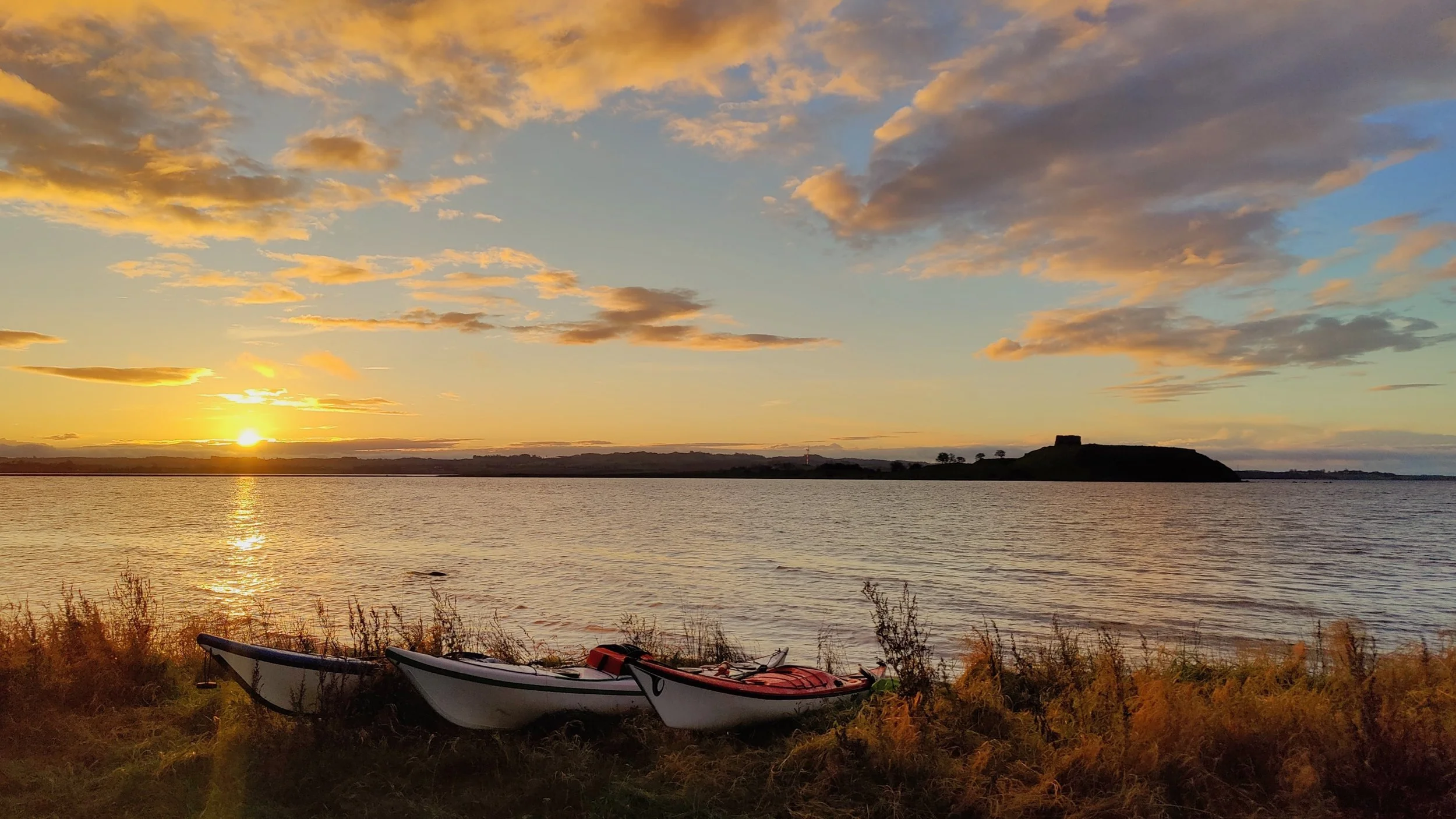
Aarhus Bay
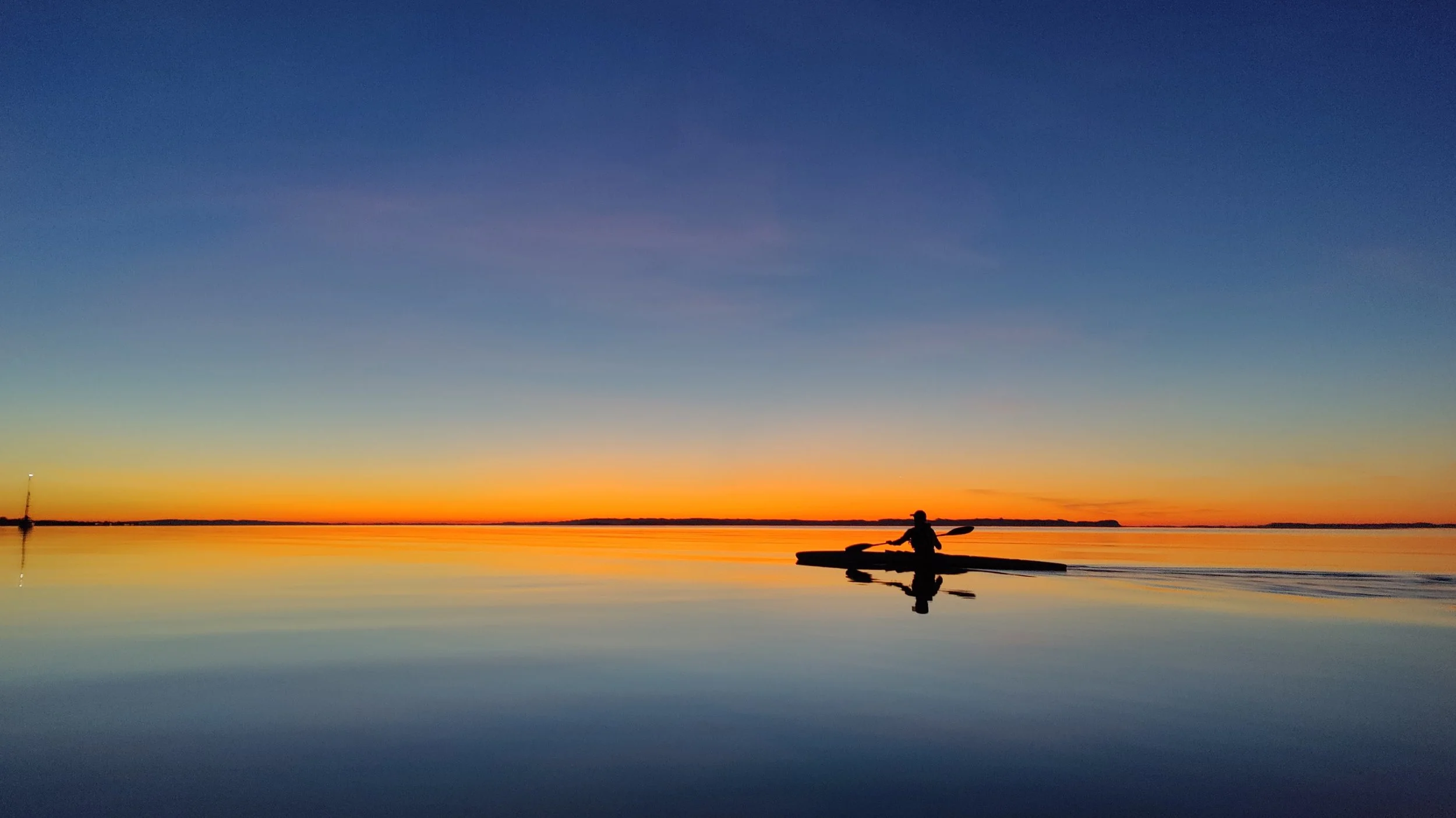
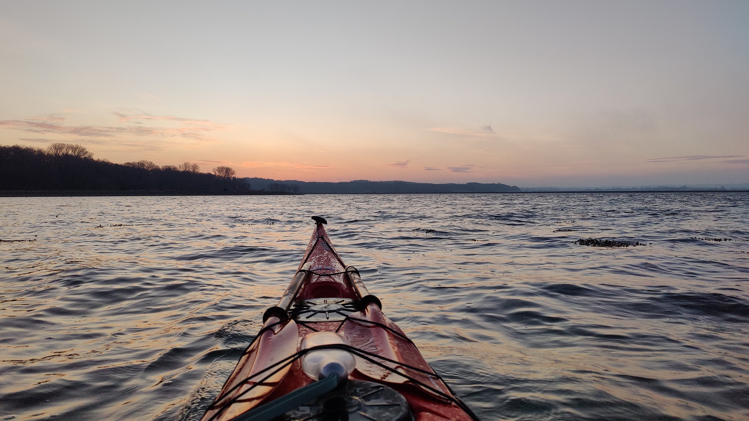
Aarhus Bugten is my daily paddling spot. This is where I have paddled the most over the years.
The bay is fantastic for both day trips and is also the perfect size for a weekend trip. Depending on how close to the coast you paddle and where you choose to cross, the trip is 45–55 km.
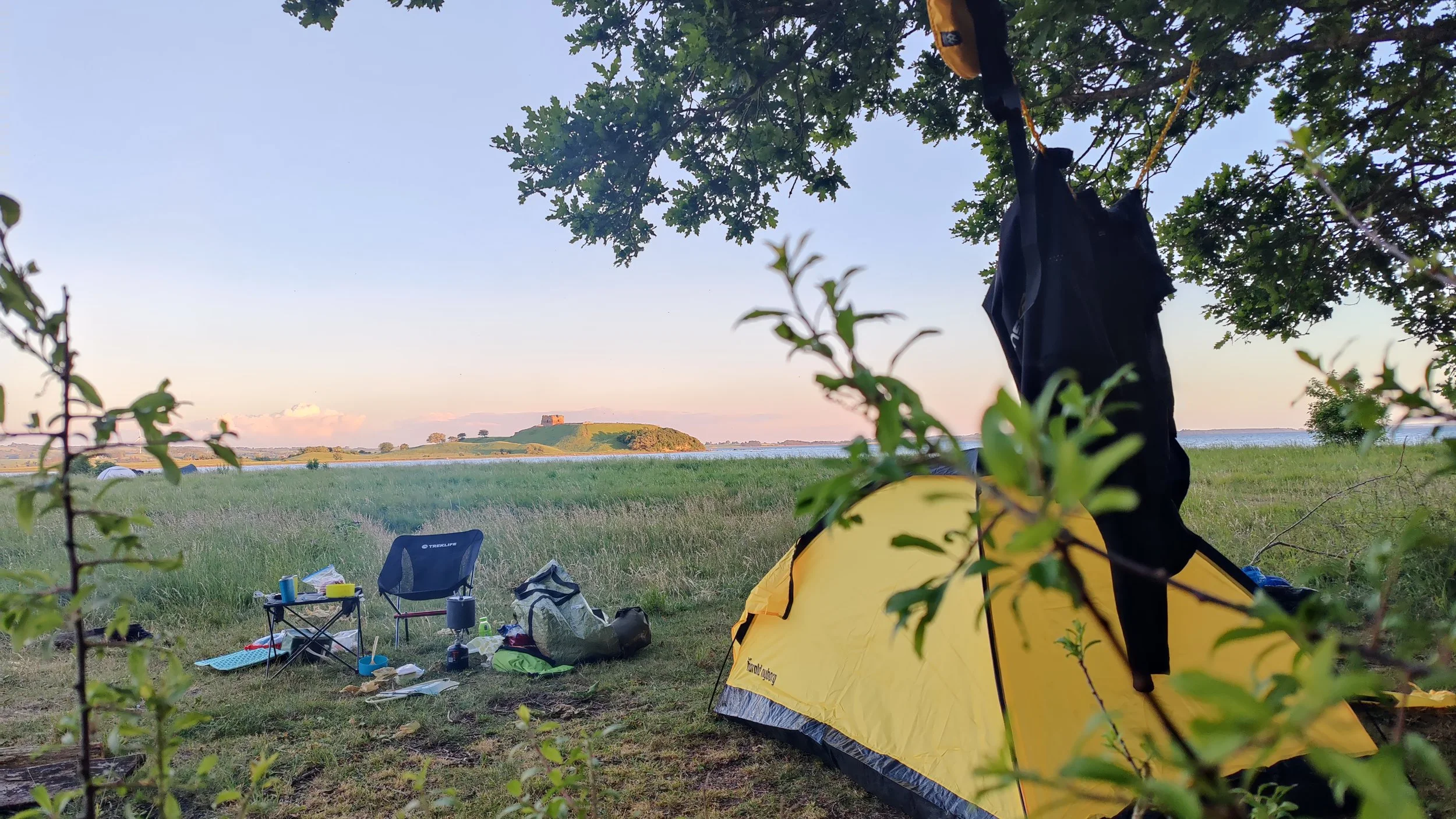
In the northern part of Aarhus Bugten you will find Hestehave Skov and the associated tent site. It is a primitive tent site with access to toilets about 1 km up the path by the parking lot to Kalø Slotsruin. If you start in Aarhus' northern marina, this tent site is about half way. However, there are also shelters along the way at Kaløvig Bådelaug and Skødshoved beach, so the trip can start in different places (see the danish app called shelter).
The walk out to the castle ruins is a wonderful experience in both daylight and at night. When darkness falls, the sky often opens up with a beautiful sea of stars.
Remember to bring a headlamp. The path to the toilets (and ruins) is dark and partly through the forest, and in several places it can be very wet and muddy. It may therefore be a good idea to bring waterproof hiking shoes.
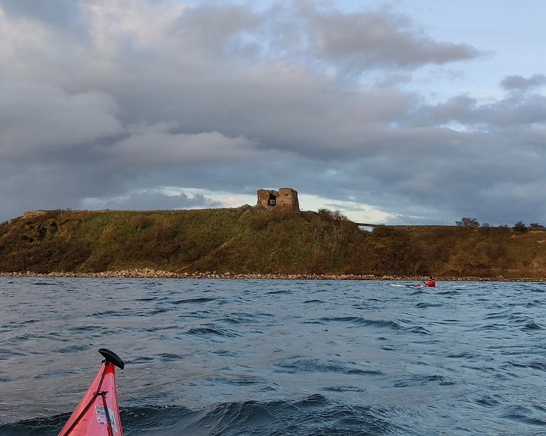
Kalø Castle Ruins
Kalø Castle Ruins dates from the early 14th century and is one of Denmark's best-preserved medieval ruins. The ruins are located on a small peninsula, which is connected to the mainland via a cobblestone causeway. From here there is a fantastic view of the Bay of Aarhus and the surrounding landscape. Today the area is a popular excursion destination and a beautiful place to experience sunsets - and on clear nights also the starry sky far away from the city lights.
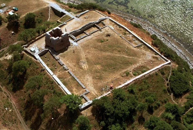
The images above come from the National Museum's website: https://natmus.dk/historisk-viden/temaer/ruiner/kaloe-slot/
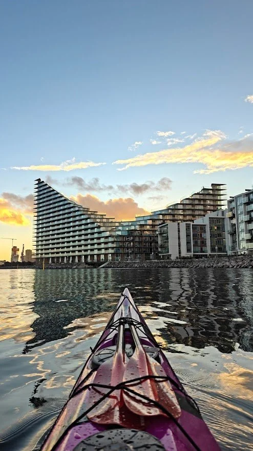
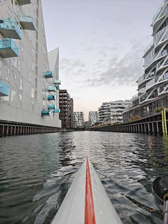
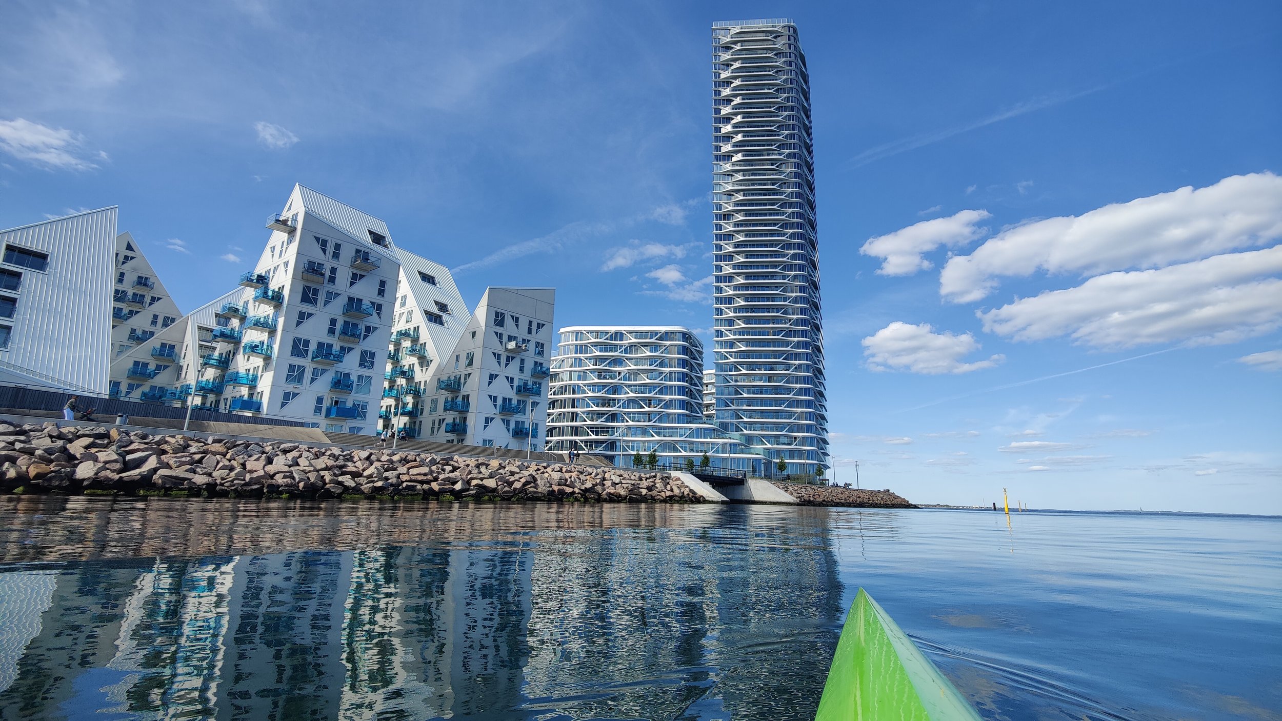
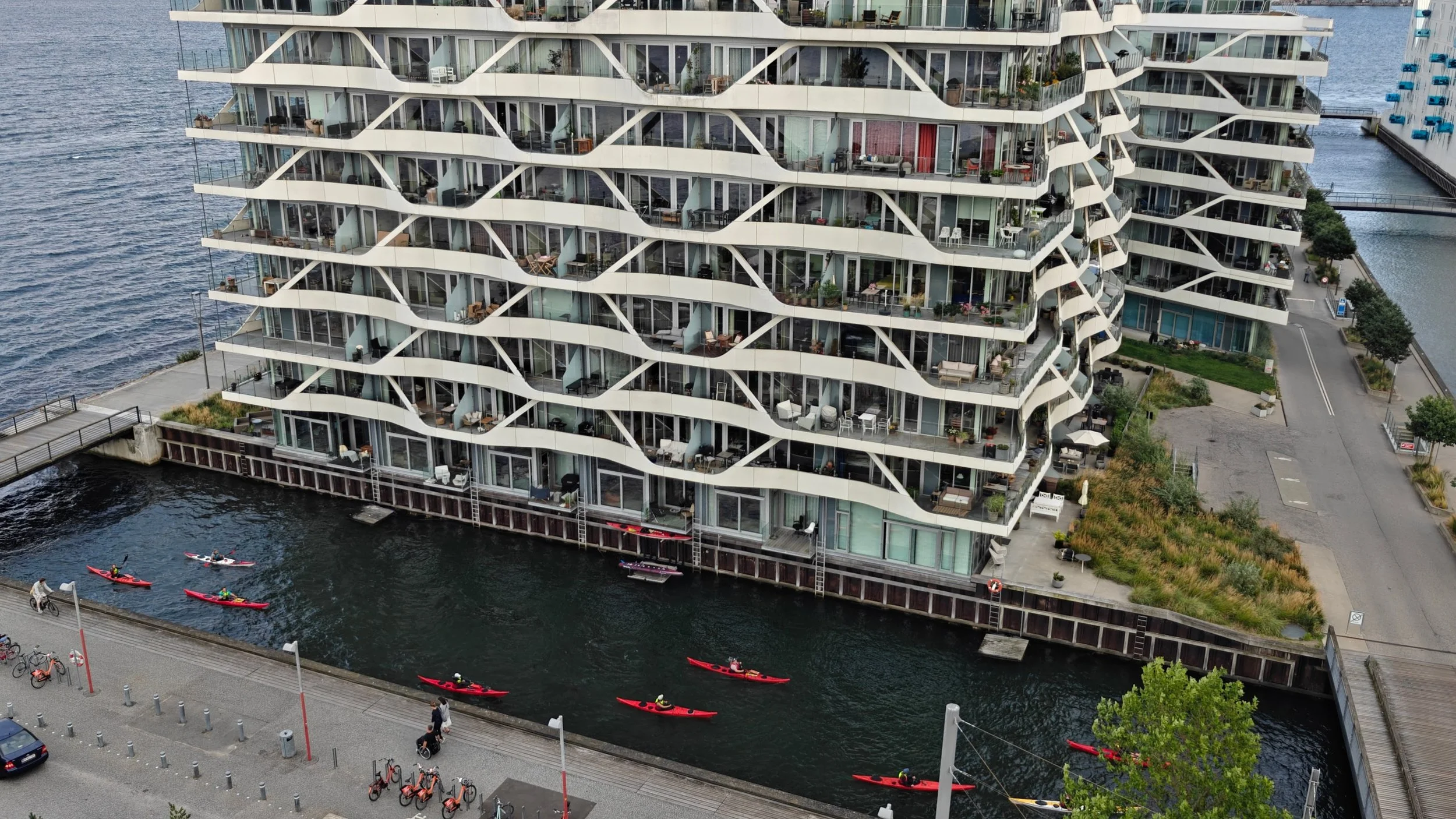
The area, which was formerly an industrial port, has since 2007 been transformed into a modern residential and marina environment with distinctive architecture and life along the quays.
Aarhus Ø is an artificially created island, which today houses around 6,000 residents and Denmark's tallest residential building, the Lighthouse, which, at 142 meters, dominates the city skyline. Canals run between the buildings, providing unique opportunities to paddle up close to the architecture and experience the district from a different perspective.
Take a paddle through Aarhus Ø and experience the new district from the waterside
Add Aarhus Ø and City as an little extra
Paddle through Aarhus city
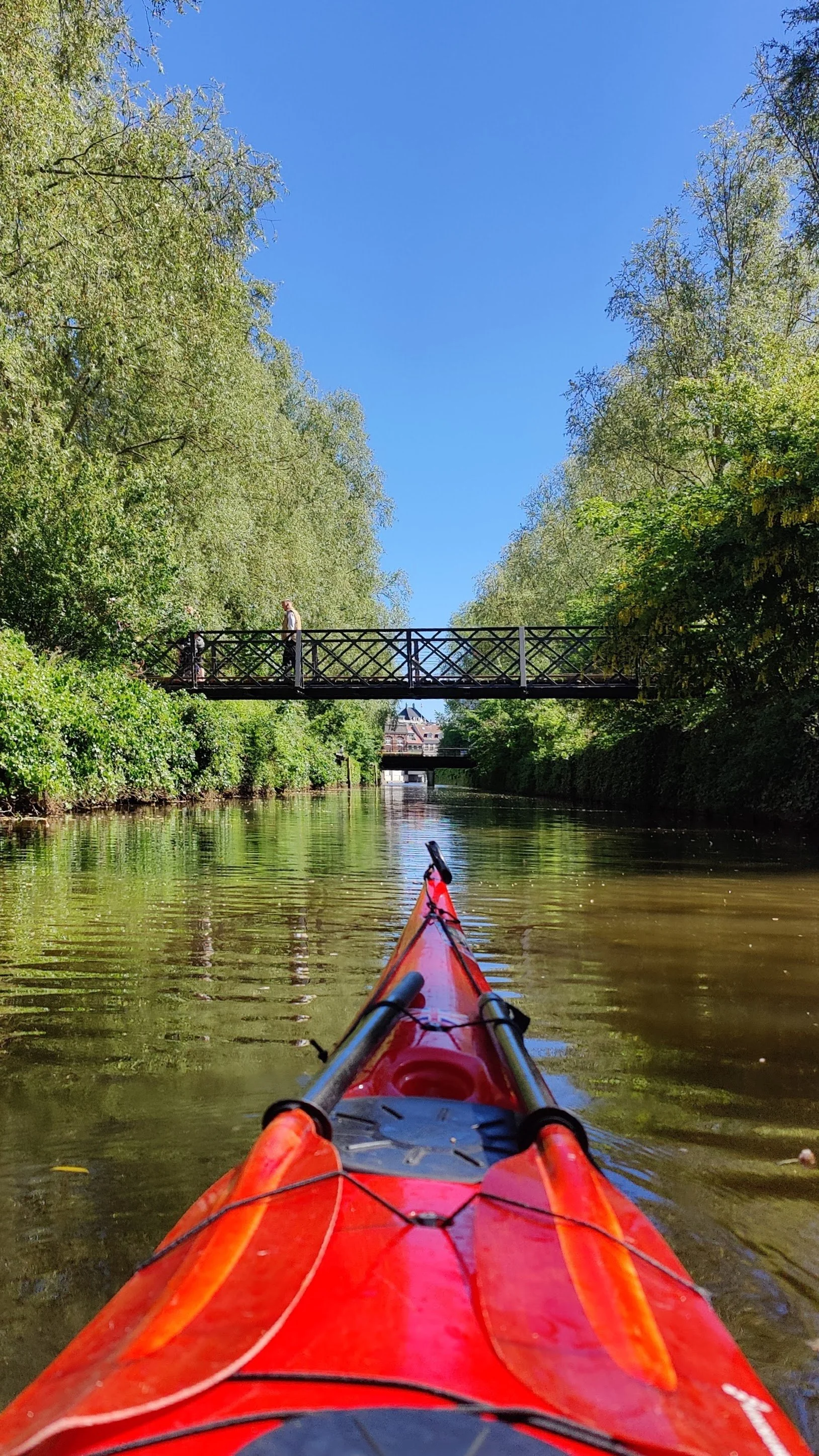
From the marina, you paddle through the canal towards Dokk1 – the city’s modern culture and media center, which opened in 2015 and is now one of Northern Europe’s largest libraries. From here, you can make a short transfer and continue directly up Aarhus Å.
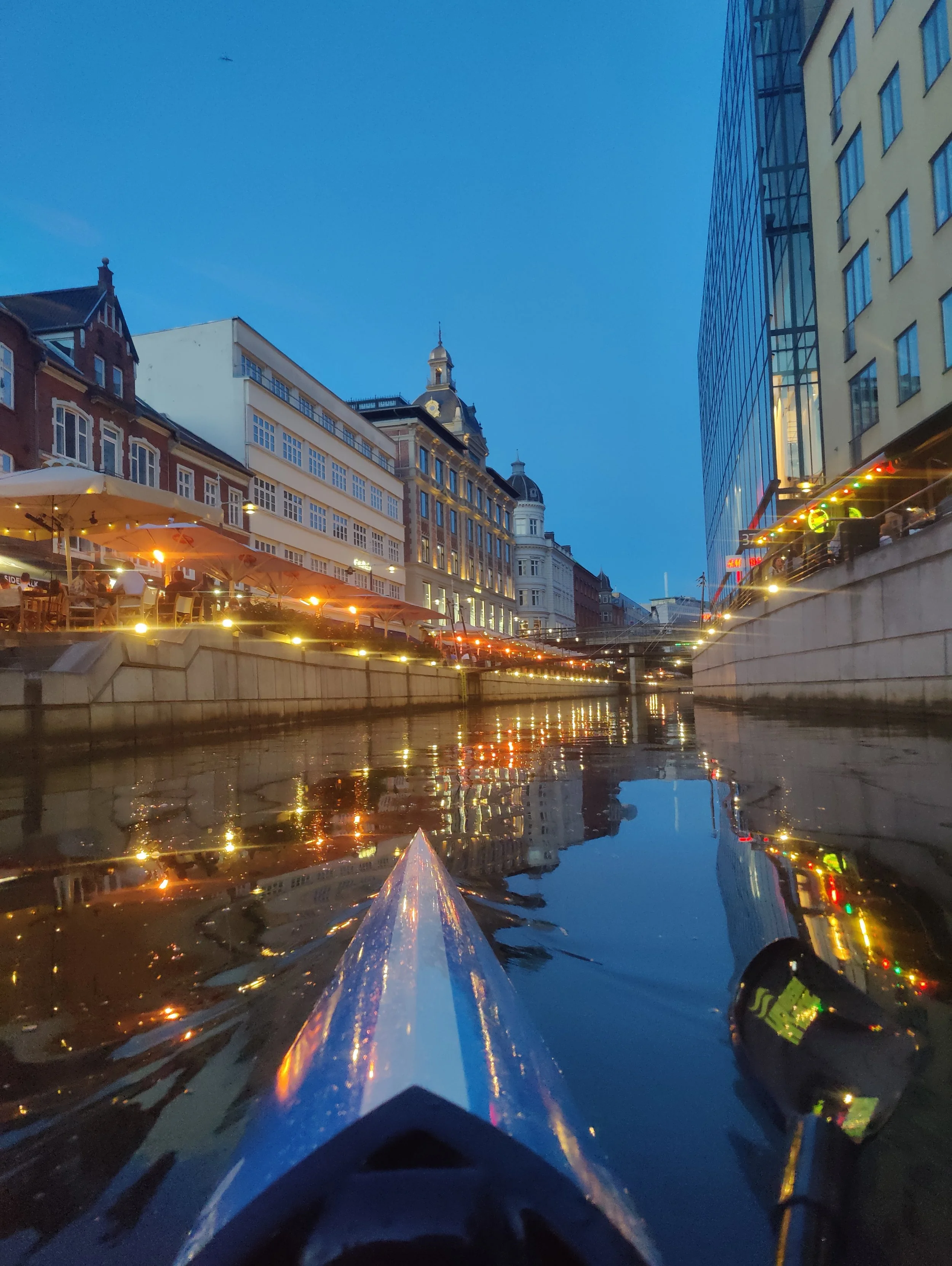
When you paddle up the canal, you move into the heart of the city. You glide past cafés, restaurants and the big shopping mall Magasin, while city life unfolds along the banks. Aarhus Å was reopened in 2008 as part of the city’s urban renewal and has since been a popular and atmospheric area — both on foot and from the water.
The trip can be continued much further than many people think. It is possible to paddle all the way up to Brabrand Lake and the rowing stadium, where the city is gradually replaced by greener surroundings and quieter stretches.
At low tide, at the wind farm, you may risk having to carry the kayak across the road or jump into the water and pull the kayak over the elevation that can be found under the bridge.
Distance from the inner harbor/Søsporten (round trip):
• Dokk1: approx. 3 km
• Magasin: approx. 4 km
• Mølleparken: approx. 5 km
• Brabrand rowing stadium/club: approx. 20 km